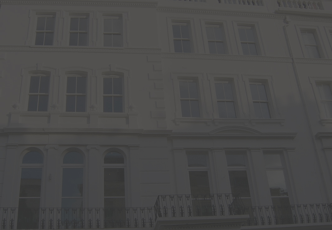
A superb white stucco freehold buildings comprises of 8 luxury flats with a lift . Lies within the parish of Paddington and the Westbourne Conservation Area in the City of Westminster.

Westbourne Grove is the area lying to the west of the river Bourne or Westbourne.
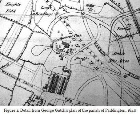
In the early 19th century the area around the present Westbourne Gardens was occupied by Westbourne Park, the home of Lord Hill. George Gutch’s plan of 1840 shows the state of development in the area at that time (figure 1). It will be noted that the line of the future Great Western Railway was already by then scheduled to run through Westbourne Park, and anticipation of the arrival of the railway (Paddington Station did not open until 1854, but the cutting of the railway line began as early as 1836) provided the spur for the development of the area. The proximity of the line persuaded Lord Hill to sell up (although the house survived for some time afterwards), and most of the area between Bishop’s Bridge Road and the railway had been developed by the mid 1850s.
William Kinnaird Jenkins and the development of Garway Road
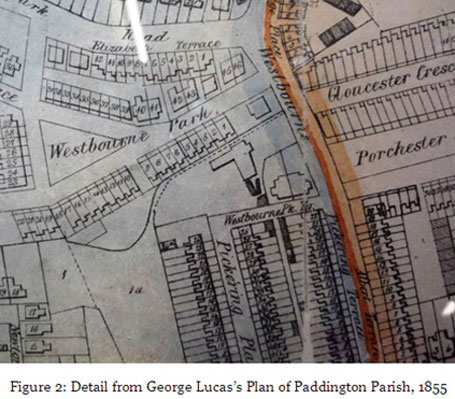
The development of Westbourne Gardens (or Westbourne Park as it was originally called) took place around a new triangular ‘square’ in the mid 1850s, and is shown on George Lucas’s Plan of Paddington Parish, 1855 (figure 1). It is a development of tall stuccoed terrace houses with grand entrance porches and Italianate detailing. Originally the houses were numbered consecutively, and the present numbers 3 and 5 are shown on Lucas’s plan as 1 and 2. The site of the present no. 1A is shown empty. However, it is clear that not all the houses were occupied, or even built, at this time. Watkins’ Directory of 1855 lists only nos. 18-40 (on the west and north sides) as occupied, while the Post Office Directory for 1856 lists nos. 3-46 as occupied. The 1857 Directory lists nos. 2-46 as occupied, and it is not until 1858 that no. 1 is listed (Currently no 3).
Early Occupants
The occupant is given as Henry Hill, Esq. The 1858 Directory also mentions a no 1A, not the present 1A, possibly a flat in part of no. 1 (currently no. 3), occupied by Mrs Richardson, no. 2 (oc
The 1861 census return tells us a little more about the then occupants. It confirms that no.1 (the present no.3) was still occupied by Henry Hill Esq., listed as a ‘Gentleman’, aged 76. He lived there with his wife of 79, two daughters and four servants. No. 2 (the present no.5) was occupied by Daniel Goodman Squirhill, aged 53, of ‘no occupation’, with his wife Louisa, 57, their daughter Jeanette, aged 22, and two servants.
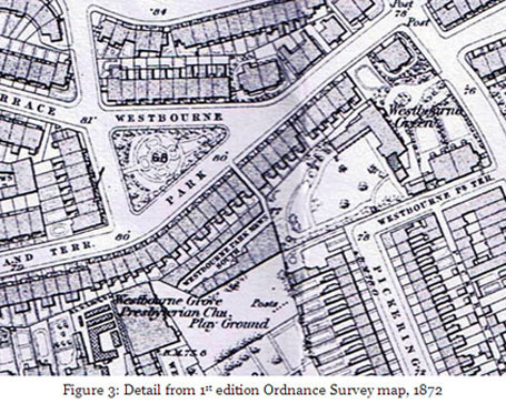
The first edition Ordnance Survey map of 1872 (figure 3) shows the development in greater detail than the Lucas plan. It shows the formal layout of the triangular garden at the centre of the development and other (now demolished) properties and an open space, Westbourne Green, to the east, on the site of the present Porchester Hall and baths. This open space spills out onto Westbourne Park (Gardens), the site of the future no.1A.
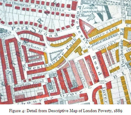
These were houses built for the well-to-do. The first edition of Charles Booth’s Descriptive Map of London Poverty of (1889) divides properties into seven categories, identified by colour. The lowest was black (‘lowest class, vicious, semi-criminal’) and the two highest categories were red (‘middle class, well to do’) and yellow (‘upper-middle and upper classes, wealthy’). Westbourne Park (Gardens) is shown as yellow, while most of the immediately surrounding streets are red (figure 4).
This assessment is confirmed by census returns, which tend to list occupants as gentlemen or professionals (solicitors, doctors etc), typically employing two to four servants. The 1891 census is of some interest, revealing that the then owner of no. 1 (the present no.3) was Siegmund Heckscher, aged 50, a German importer of pianoforte materials (a family business which continues to this day in Bayham Street, London NW1). Heckscher lived at no. 1 with his wife Johanna, aged 48 and their ten children: Siegfried (24), Rosalie (23), Leo (21), Charles (19), Max (16), Ida (14), James (12), Manuel (8), Melissa (8) and Bessie (6). They employed one cook and one servant. Meanwhile, at no 2 was Georgiana Aikman, aged 75 and ‘living on her own means’, her sister Sarah, aged 60 (also with a private income), and two servants.
Later changes
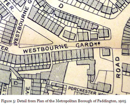
The street appears as Westbourne Gardens for the first time on the 1901 Plan of the Metropolitan Borough of Paddington (figure 5). The land to the south is shown unaltered since Lucas’s map, but this was to change with the building of Porchester Hall and Baths in 1925-29. It was as a reading room extension to the library in Porchester Hall that the present no. 1A on the infill plot next to no.1 was built in 1938, by Thomas Bros of Sudbury, Middlesex. With its strip window and porthole window, this little building (figure 6) ‘strikes a blow for the modern movement’ (The Buildings of England) amidst the Italianate stucco of Westbourne Gardens and the flamboyant Beaux-Arts Baroque of Porchester Hall.
Bibliography/Sources
Cherry, B. and Pevsner, N.: The Buildings of England, London 3: North West, 1991
Victoria County History: A History of the County of Middlesex: Volume 9: Hampstead, Paddington (1989).
Directories, maps and census returns held at Westminster Archive Centre.